
-- Time devoted to pleasure, rest, or relaxation, whether from school or from work. Especially great if taken with pay.
June 30, 2008
Florida Revisited
1987 is somewhat a fuzzy memory to me. We flew in from Mississippi and stayed with a friend in Tampa. I traveled with my Mom.
In 2002 we went to Florida with my Wife’s cousins. They came down from New York and met us in Virginia, and we all drove to Florida from there. Funny things happen when you have a caravan of four vehicles, no one has a GPS and you have passengers who need a lot of bathroom breaks. For one thing, you get to see and experience all the rest area along the way, and you tend to take long breaks. We left Virginia on a Thursday afternoon. We got to Orlando, Sunday at noon.
Before this trip I have never really traveled south. I've always gone up north I-95 from Maryland. I had to pay a toll fee but the rest areas were all inside the interstate highway, had gas stations and restaurants. Going south from Maryland, there were no tolls to pay but the rest areas only had vending machines that did not make decent coffee. If you wanted to eat you either brought your own (which we did), purchased from the vending machine or left I-95 in search of a restaurant. The worst rest areas were in Florida. These seemed to be barely used. Maybe it was because of those huge signs that read in part “Rest Area not Patrolled at Night”.
2006. Learned a couple of lessons from the last trip. First, bring a GPS. I had the Garmin Street Pilot i3. We had a few quick stops but otherwise drove the whole time. The trip took us about 17 hour.
We stayed at the Westgate Lakes Resort and Spa in 2002 and 2006. It is very nice place. If you rent a unit and there are more than 2 people in your group, make sure to ask for the main area of the unit. This is where the main kitchen, huge bath and plenty of space can be found. The smaller half is, now how shall we say it, a little too small. You will find plenty of activities if you are not that determined to take on the crowds at Disney World. The resort has swimming pools and bike trails you can use, you will also find a lake that you could go boating in. As for us, we came to visit Disney World.
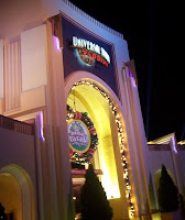
Disney World was great, what can I say? The kids loved it; one week is definitely not enough to see the whole place. On this trip the kids started looking for more excitement, the kind of rides that teenagers crave. So we took a day off Disney and visited Universal Studios. I can already see that the next time we visit Florida, we, or rather the kids, will be going to Universal rather than Disney World.
That other lesson I learned? I need to avoid the hot, sticky months of July and August. It is hard to get anything done when you are trying to avoid a complete meltdown, literally. November or December is perfect.
June 21, 2008
Tools of the Trade: GPS
Despite all the benefits of internet mapping services like Mapquest, Yahoo Maps or Google, I soon found that there was one thing they could not do for me. If I made a wrong turn somewhere as we are all apt to do, I could not find directions on how to get back on the right track. Now this is not too bad on city streets but on a freeway it can be an issue. I still needed to have a map!
Enter the GPS! The perfect solution for most situations you will encounter. I started out on the lighter side, opting for the Garmin Street Pilot i3. Despite what I have heard, I had some reservations about using a GPS. The GPS may not function as advertised and I did not want to be tied to an expensive unit I could not use or appreciate. Needless to say I was sold. The Street Pilot does a pretty good job of giving turn-by-turn instructions, arrival time among others. When I chose the Street pilot I knew the small screen size (1.3 x 1.7 in) might become an issue later but I figured, I needed to hear the instructions, not read it. As I gained more experienced with the GPS, I found situations where you did need to take a quick glance at the screen and read some of the information displayed, like street names. Now while doing so in the daytime was not much of an issue, the black and white screen was hard to read at night. I also learned that the turn-by-turn instructions can be confusing when you have two or more exits close to each other. Thankfully by this time newer, more advanced GPS had come down in price and was now more affordable to the masses, like myself.
The TomTom Go 720 had a 4.3 in colored screen that is easy to read. I could have gone for the Garmin nuvi 760 and stayed with more familiar territory. After all they had very similar features. Both had touch screen controls, same screen size, FM transmitters, blue tooth wireless connections, MP3 player, and photo viewer. Battery life for both GPS models where similar. Where they did differ is in the map providers. TomTom uses maps from TeleAtlas while Garmin gets its maps from NAVTEQ. What made me choose TomTom over the more popular Garmin? It is the TomTom MapShare, feature that lets users share map corrections with each other. I haven’t really used this yet. The last time I checked there were no map corrections in my area but I think that I may find this feature useful...eventually.
I do have a little regret going for the TomTom. Go 720 instead of the Garmin nuvi 760. I’m sure that both do a good job getting you to where you are going but the TomTom tends to stick to highways and freeways when going through city streets might actually be both faster AND shorter. Garmin does not, or at least the i3 did not. Oh, and another thing. When approaching your destination, the Go 720 tells me that I am arriving at my destination. The Garmin goes so far as to tell me that it is on the right side of the street, or on the left, a little extra information that I now miss.
Hmm, maybe this is a situation where I should be trying out the MapShare feature.
June 20, 2008
Memorial Day 2008
A short trip during Memorial Day weekend has always left me apprehensive. A lot of people just like going to the beach that weekend. Me? I don’t like too much crowd. So I avoid the beach. But where do you go on such a nice, cool and pleasant day like May 26, 2008? With gas prices the way it was we had to go somewhere close. Somewhere you could have a picnic, run around and soak up the sun from under a shaded tree. Somewhere like The Black Hill Regional Park in Maryland, a mere 7 miles away from our home.
The Black Hill Regional Park is a 1,843 acre park located in Montgomery County, Maryland, and encompasses the Little Seneca Lake (505 acre) and offers a variety of activities such as:
- Picnic tables and shelters
- Rowboat, kayaking or canoing
- Launching and mooring private boats
- Riding the pontoon boat around the lake
- Fishing
- Paved and natural trails
- Volleyball courts Children’s playground
- A half-acre sized dog park
- Educational programs
- A beautiful view of the lake
Some of these services such as renting a picnic shelter or riding the pontoon boat do require a fee. If you prefer not to spend money there are plenty of alternatives, no fees attached.
Now this is not the first time we’ve gone to this park. The MCPAA has had more than a few picnics there that we have actually attended but this is the first time we are going at the spur of the moment, with only two days to plan. And we had a plan to avoid the crowds, make sure we got a good spot and have some fun. We would go with some friends, each family bringing a different kind of meal for variety. Pot Luck you know. And we would go early to beat the crowd, something like 8 am. That way we could choose the best, most comfortable, under-the-shade spot. Now that was a plan! And everything went on exactly as planned, except for that 8 am thing. Our friends got there 9 am, we made it around 11:30 am, a minor setback that prevented us from having the choicest spot available. But it was shaded.